

b-bark

Descrizione di b-bark
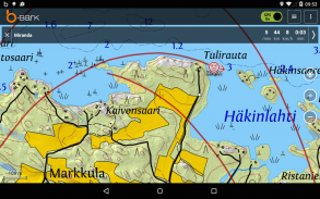
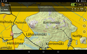
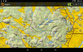
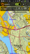
b-bark is an excellent mobile terrain and topographic map application for hunting, dog tracking, hiking, geocaching and other outdoor activities. You can go into the outdoors with confidence and enjoy your activities without worrying about the tools to help you navigate. Find your own ways to have fun in the outdoors with b-bark!
Supported maps:
- Worldwide street maps (OpenStreetMap)
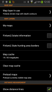
- Finnish terrain map, aerial photo, and estate information
- Finnish nautical maps
- Swedish terrain map
- Norwegian terrain map
- Estonian terrain map and aerial photo
- Custom maps you can create yourself from photos or scanned images.
What you can do with the license free version?
- Use all maps for free
- Store POIs locally
- Store area markings locally
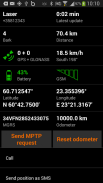
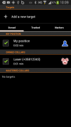
- Track yourself
- Use MPTP tracking
By purchasing the b-bark software license you will get the following additional features:
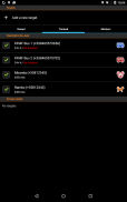
- Track other b-bark users
- Track b-bark collars
- Store POIs and area markings in cloud server
- Share POIs and area markings with other b-bark users
- Share your custom maps with other b-bark users
- Use the history view to see old tracks stored in the cloud server
- Use chat feature to communicate with other b-bark users
License and tracking device can be purchased from the b-bark web store or from the nearest retailer.
For more information see www.b-bark.com
Please send us your feedback or request: support@belectro.fi
b-corteccia è un ottimo terreno mobile e applicazione carta topografica per la caccia, l'inseguimento del cane, trekking, geocaching e altre attività all'aperto. Si può andare in all'aria aperta con fiducia e godetevi le vostre attività senza preoccuparsi gli strumenti per aiutarti a navigare. Trovare il proprio modo di divertirsi all'aria aperta con b-corteccia!
mappe supportati:
- In tutto il mondo le mappe stradali (OpenStreetMap)
- carta geografica del terreno finlandese, foto aerea, e le informazioni immobiliare
- carte nautiche finlandesi
- carta geografica del terreno svedese
- carta geografica del terreno norvegese
- carta geografica del terreno estone e foto aerea
- mappe personalizzate è possibile creare voi stessi da foto o immagini digitalizzate.
Che cosa si può fare con la versione gratuita di licenza?
- Utilizzare tutte le mappe gratis
- Conservare POI localmente
- marcature zona memorizzare in locale
- Traccia te
- monitoraggio Usa MPTP
Acquistando la licenza del software b-corteccia si ottengono le seguenti funzionalità aggiuntive:
- Traccia altri utenti B-corteccia
- Traccia B-corteccia collari
- POI Store e zona marcature in server cloud
- Condividi POI e zona marcature con altri utenti B-corteccia
- Condividi le tue mappe personalizzate con altri utenti B-corteccia
- Utilizzare la visualizzazione della cronologia per vedere i vecchi brani memorizzati nel server cloud
- funzione di utilizzare la chat per comunicare con altri utenti B-corteccia
Licenza e dispositivo di tracciamento possono essere acquistati presso il negozio web b-corteccia o dal rivenditore più vicino.
Per ulteriori informazioni, vedere www.b-bark.com
Vi preghiamo di inviare i vostri commenti o richiesta: support@belectro.fi


